A major hail event occurred in the north suburbs of Dallas on Monday, April 11. Some media I thought worth saving are captured below. [Reminders: more than anything, this is archive of images and links that I might use in future classes. I may add more later, or delete some of these. If you have any sources that you think complete or improve on this set, please do share.]
Let’s start with the geography of the event:
Several hail and thunderstorm wind reports from Monday's storms. The largest hail was 4.25" in Wylie. #dfwwx #txwx pic.twitter.com/0URR5cCKqW
— NWS Fort Worth (@NWSFortWorth) April 12, 2016
The Severe Thunderstorm Warning that included Wylie, focus of some of the videos below:
547 PM: Hail up to baseballs moving into Frisco, Allen, N Plano areas (Collin Co). Take shelter NOW! #dfwwx #txwx pic.twitter.com/bjG8vXo4Dz
— NWS Fort Worth (@NWSFortWorth) April 11, 2016
Videos
Slow-motion video of baseball or softball hail crashing into a pool:
Another insane #hail video from Wylie, Texas on 4/11/16 in meteor storm-like slow motion (via @CBSDFW) pic.twitter.com/BckmCjAPaX
— Sam Shamburger (@shamnadoes) April 13, 2016
Additional good ones:
- Video of golf- to tennis-ball sized hail falling in Wylie, TX: https://twitter.com/WylieFireRescue/status/719663655176900608
- Do not stand near windows during a hailstorm! Ever! https://twitter.com/CBS11Andrea/status/719672304582533120
Photos
I don’t know how big this person’s hand is, but does it really matter?
Insane hail stones in Wylie, TX yesterday via Kristin Baxter pic.twitter.com/Rsy142MtOP
— Rob Marciano (@RobMarciano) April 12, 2016
Additional good ones:
- Holes punched in the yard: https://twitter.com/Saulgarzafox4/status/719887960980611075
- One of these days, a traffic jam caused by this stupidity will lead to fatalities. I’ve watched way too many episodes of “Cops” to know that parking anywhere near an interstate is idiotic: https://twitter.com/Fox4Weather/status/719656271620608000
Meteorology
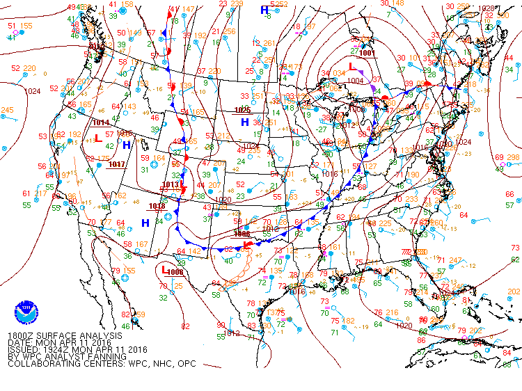
- The focusing mechanism for convection: a surface low, frontal boundary and dryline. The WPC’s surface analysis at 1800 UTC:
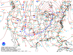
- The full complement of upper air charts for 1200 UTC (11th) and 0000 UTC (12th) is available via the Storm Prediction Center’s archive.
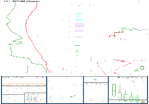
- A 9-h forecast sounding from the 4km NAM for 2100 UTC (model initialized at 1200 UTC). Over 3000 J/kg of CAPE, no matter how you calculate it!
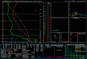
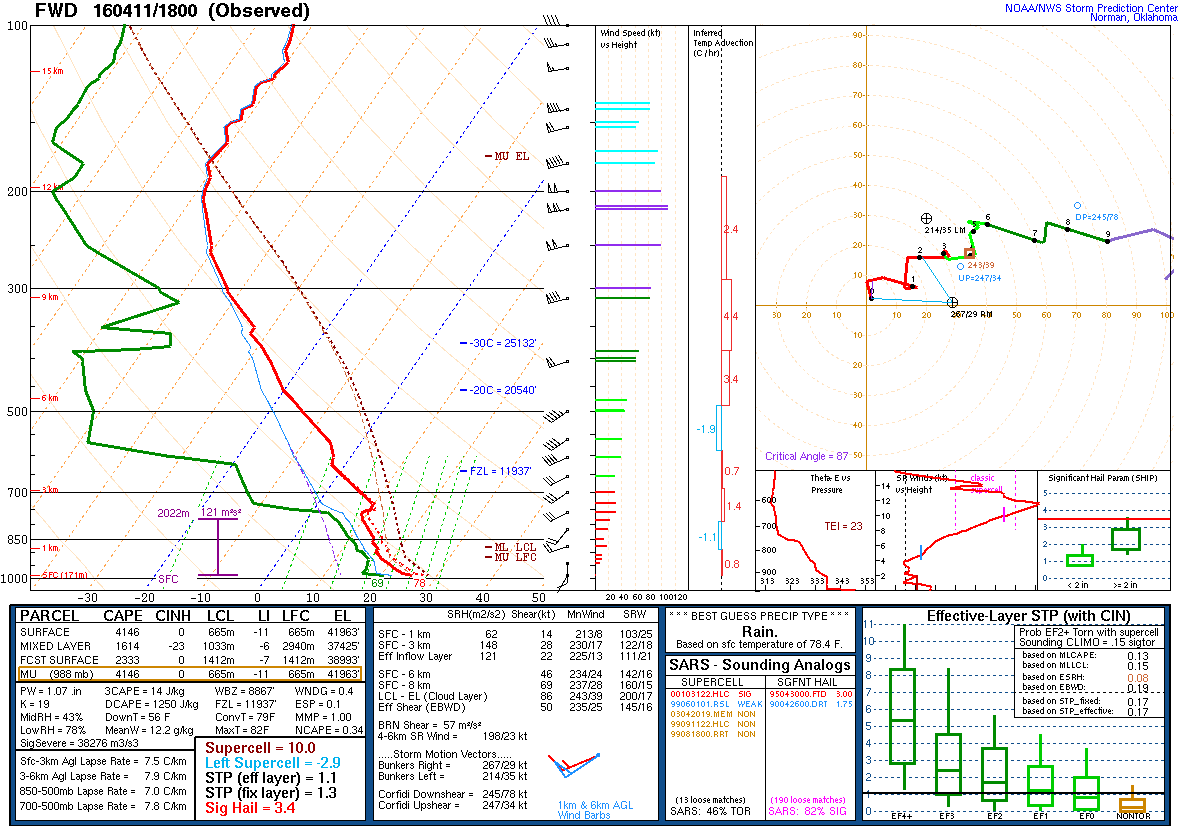
- And if model soundings aren’t your thing, the observed, pre-event FWD sounding at 1800 UTC. But note that in this case, there’s a 2500 J/kg difference between surface-based and mixed-layer CAPE; the high surface dewpoint may be anomalous.
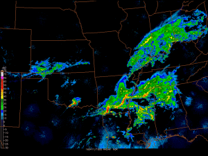
- A regional radar loop that honestly isn’t that breathtaking, but illustrates the isolated supercell nature of this hail producer.
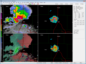
- At one point, about 2200 UTC, the storm had a textbook high-precipitation supercell look. Upper left and color bar: reflectivity at the lowest elevation angle. Lower left: storm-relative velocity. Upper-right: VIL (the scale maxes out at 80 kg/m2, but I found a value of 121!!!). Lower right: radar-estimated maximum hail size, with one pixel indicating 2.98-inch size. Probably one too many significant figures there, but I digress.