A strong tornado struck areas west of Chicago on Sunday night, June 20. A quick set of maps and data to remind myself about the event & what to talk about when it comes up in class.
Where
Environment
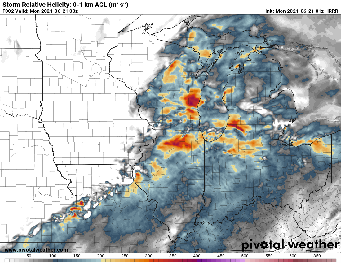
The proximity sounding from KILX, with high CAPE, low LCL/LFC, and a very large 0-2 km hodograph but unidirectional winds above. All the convection-permitting models showed that this parameter space extended into N IL, to the convection itself (0-1 km SRH shown, but CAPE, other shear parameters, and therefore all the composite parameters demonstrated the same).
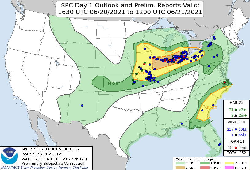
The tornado occurred smack in the middle of the “enhanced” risk region. (As of the time this post was written, the tornado report was not yet included in the SPC database — but it should appear eventually.)
Storm
A very obvious debris signature just before 11:30 p.m. CDT. At first, I thought it odd that the velocity couplet wasn’t gate-to-gate — as it usually appears — but at this distance the radar is sampling at only 700-800 feet off the ground. That’s the tornado itself.
A combination of power flashes, lightning, and maybe a beacon on top of a distant tower:
The storm lofted debris to nearly 20,000 feet (at least one image showed possible lofting a few thousand feed higher). Based on radar climatology, the strength of the rotational signature and height of the likely debris indicated a high probability of EF2 or EF3 damage.